Website profiles · Technology insights · Alternatives

lizardpoint.com No paid content found

Categories: Education & Learning

Interactive map quizzes to help you learn or study geography. Over 200 map quizzes on world countries, states, cities, rivers, flags and more. Get a free account and save your score, track your progress. Customize quizzes to make exactly the quiz you need to study. Teachers can access their students scores.

Visit website

Updated: 2026-09-30 14:58 Language: English (default) Access: Normal

Profile views 2 Outbound visits 0
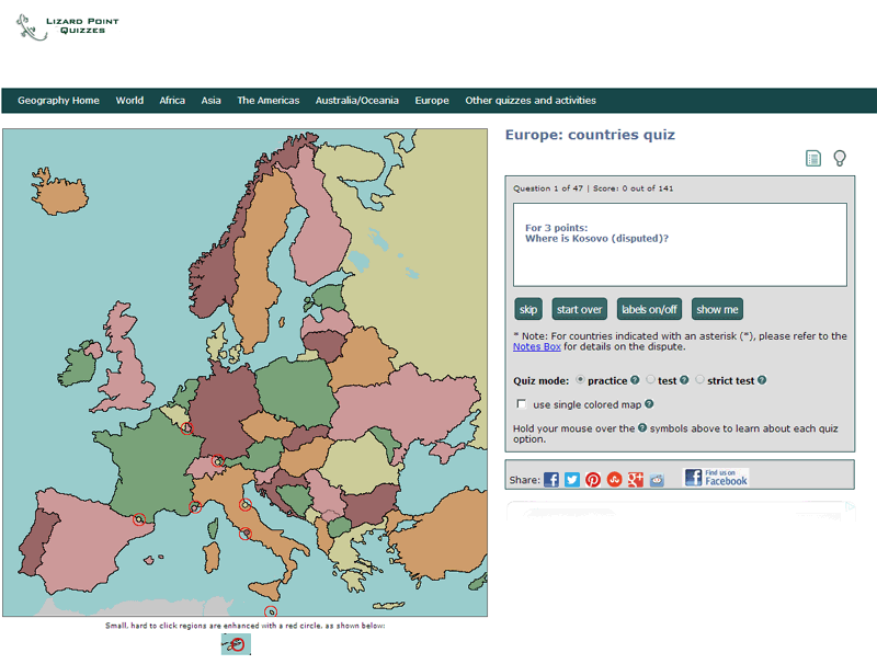
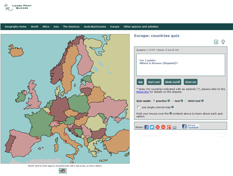
Lizard Point Quizzes Full homepage screenshot
Editorial Review

Website Review

What is Lizard Point Quizzes?

Lizard Point Quizzes is a free, browser-based geography practice site built around interactive map quizzes. Instead of reading a static atlas, you click on a map to place countries, states, cities, rivers, and other features, and the quiz tells you right away whether you were correct. The site says it offers over 200 map quizzes covering world countries, U.S. states, cities, rivers, flags, and more, plus a large collection of geography trivia quizzes on topics such as capitals, landmarks, and geo-history.

It is designed for a wide range of learners: the site mentions elementary, middle and high school students, colleges and universities, homeschooling families, and adults who want to follow the news with better geographic context. Teachers get their own section, and the site notes that educators can view student scores, which makes it more than a solo study toy.

What you can actually do

  • Map quizzes: Identify countries, states, cities, physical features, and flags by clicking on a map.
  • Trivia quizzes: Several hundred questions on geography definitions, capitals, landmarks, and history.
  • Beyond geography: Sections on world leaders, flags, art and artists, math worksheets, and games for kids.
  • Customization: The site says you can customize quizzes to build the exact study set you need.
  • Progress tracking: A free account lets you save scores and track progress over time.

Who it suits, and the trade-offs

Learner Good fit because Watch out for
K–12 students Immediate feedback turns practice into a game; anxiety drops when you can retry Younger children may need an adult to help navigate quiz categories
Teachers Student score access and customizable quizzes support weekly practice and quiz days It supplements, rather than replaces, a full curriculum
Homeschoolers Free, self-paced, and usable across ages Parent involvement still matters for structuring a sequence
Adults Quick, low-stakes way to sharpen news geography Trivia depth varies by topic; some sections are broader than others

A testimonial from Cora Roselli, a professor at Conestoga College, reports that her students were engaged and learned in a fun, interactive way. Carol Miron of Don Mills Collegiate Institute observed that immediate feedback and the chance to practice before a test motivated students to retry and reduced test anxiety. Those are instructor observations rather than independent research, but they point to a real practical benefit: repeated low-stakes attempts build recall faster than one high-stakes test.

Next step: If you are studying for a specific quiz or exam, start with a broad regional map quiz, note the countries or features you miss, then use the customization option to drill just those items. A free account is worth creating if you want to see whether your accuracy improves across sessions. For a different style of map practice, you could also compare with Seterra.

How can I use Lizard Point Quizzes to study for a geography test?

Use Lizard Point Quizzes as a practice loop: pick the exact region or feature your test covers, take the quiz repeatedly until your score stabilizes, then switch to a harder mode or a blank map so you are recalling rather than recognizing.

Lizard Point Quizzes organizes its material by topic, so the practical first move is to match the quiz to your syllabus rather than starting at the front page. If your test is on countries of a continent, do that map. If it covers capitals, physical features, rivers, or flags, those have their own sections. The site also notes that quizzes can be customized, which matters when your teacher tests only a subset of a region.

A study sequence that works with this format

  1. Take the quiz once without preparation to see which items you actually miss.
  2. Study only the misses using your class notes or textbook, not the whole map.
  3. Retake the same quiz the next day; aim for a clean run, not a lucky one.
  4. Move to a harder variant — for example, from finding a country on a map to naming it from a blank outline, or from countries to capitals.
  5. Do a final pass a day or two before the test, mixing two or three topics so you practice switching between them.

Why the immediate-feedback design helps

Teachers quoted on the site describe the same pattern. Carol Miron of Don Mills Collegiate Institute in Toronto observed that immediate feedback and the chance to practice before a test motivated students to retry and reduced test anxiety, and quoted students saying it felt more like a game than a test. Randa Hendricks of Eastern Mennonite School in Harrisonburg, VA reported that students could practice all week and knew what to expect on quiz day. Those are teacher observations from their own classrooms, not guarantees; the underlying mechanism is simply that short, repeatable attempts with instant correction beat rereading a map.

What it is not

This is drill practice, not instruction. It will not explain why a border sits where it does, and it will not teach you the physical geography behind a feature. Use it after you have read the material, or alongside it. For deeper context on regions and borders, pair it with a reference source such as National Geographic or a world atlas.

If you are studying for a school test

Create a free account so your scores and progress are saved; otherwise you are guessing at whether you have improved. If you are a teacher or a student in a class that uses it, the site states that teachers can access student scores, which turns the quizzes into a check on who needs help before the test rather than after.

Next step: open the quiz for your weakest topic, take it once, and write down every item you missed. That list is your study plan for the week.

Can teachers track student progress and scores on Lizard Point Quizzes?

Yes. Lizard Point Quizzes is built with classroom use in mind, and teacher score access is one of its stated features: teachers can access their students' scores, and a free account lets users save scores and track progress. That combination matters because it separates two jobs—students practicing on their own, and a teacher checking who has actually done the work.

How it fits a real classroom

A typical pattern: a geography teacher assigns a set of map quizzes on countries or physical features during the week, students retake them as often as they like, and the teacher reviews scores before a Friday quiz. The site's own testimonials describe this kind of routine—teachers at Conestoga College, Michaela Community School, Don Mills Collegiate Institute and Eastern Mennonite School describe students practicing repeatedly through the week and arriving at quiz day knowing what to expect. Those are the teachers' observations, not a guarantee of how the tracking works in your setting.

What to weigh

  • Immediate feedback is the main draw: students see results right away, which supports repeated practice rather than one-shot testing.
  • Accounts are free, so the barrier to trying it with a class is low.
  • Tracking works through accounts, so you need students to sign in and use the same identity consistently. Anonymous practice sessions won't tie back to a student.
  • Quiz content spans world countries, states, cities, rivers, flags and more, plus trivia, world leaders, art and math sections—useful if you want one tool across several units rather than several subscriptions.

Next step

Create a teacher account, run one quiz yourself, then have two or three students complete it and check whether their scores appear as expected before rolling it out to a full class. If you want a second reference point for map-based practice, Seterra covers similar ground, but Lizard Point's teacher score access is the feature to verify first for your own workflow.

What types of map quizzes are available, such as countries, states, cities, or flags?

Lizard Point Quizzes offers several distinct quiz families rather than one generic map test. Based on the site's own description, the main categories are:

  • Countries — locating and identifying world countries on a map.
  • States — U.S. states and comparable regional subdivisions.
  • Cities — placing or recognizing major cities.
  • Physical features — rivers, mountains and other landforms.
  • Flags — matching flags to their countries or regions.
  • World Leaders — a separate, updated section on current political figures.
  • Trivia — several hundred quizzes covering definitions, capitals, landmarks and geo-history.
  • Beyond geography — art and artists, math worksheets, and games for kids.

The site says it hosts over 200 map quizzes and that users can customize a quiz to study exactly what they need, with a free account to save scores and track progress. Teachers can access student scores.

Which type fits your situation

If you want to… Start with Why
Learn world geography from scratch Countries Broadest foundation; other quizzes build on it
Drill a specific region States or Cities Narrower scope, faster repetition
Prepare for a class quiz Customized quizzes Lets you limit the map to the assigned region
Add variety or current events Flags, World Leaders, Trivia Different recall skills; less map-dependent
Teach younger children Kids' games and math sections Separate, age-oriented content

A practical next step: decide whether your goal is recognition (spotting a country on a map) or recall (naming it from memory), since those need different quiz types. If you are studying for a specific exam, use the customization option to restrict the map to just the countries or states on your syllabus, then repeat until your score is consistent.

How do I customize a quiz to focus on specific regions or topics?

Customizing a quiz on Lizard Point Quizzes means narrowing a broad map or trivia quiz down to the regions or topics you actually need to study, rather than being tested on everything at once. The site's description states that quizzes can be customized to make "exactly the quiz you need to study," so the customization is built around selecting a subset of content before you start.

What you can typically narrow down

  • Regions: Instead of a full world-countries quiz, focus on one continent, a group of countries, or a single country's states and cities.
  • Topics: Map quizzes cover countries, states, cities, physical features and rivers; separate sections handle flags, world leaders, art and math, so you pick the category first and then the scope.
  • Trivia vs. map format: Hundreds of trivia quizzes cover definitions, capitals, landmarks and geo-history, which suits a different kind of recall than clicking locations on a map.

A practical workflow

  1. Choose the category that matches your goal (for example, African countries rather than all world countries).
  2. Use the quiz's selection options to limit the set to your region or topic.
  3. Take it once to see your baseline, then repeat only the items you missed.
  4. If you want the score and progress remembered, a free account saves results and tracks progress over time, which matters if you are preparing for a weekly class quiz.

Who benefits most

Learner Best customization approach
Student preparing for a class quiz Narrow to the exact region and feature type on the test
Homeschooling family Start with one continent, expand as accuracy improves
Adult following the news Focus on the regions currently in headlines
Teacher Custom scope plus the teacher score-access feature to monitor students

Teachers have an extra reason to customize: the site notes that teachers can access their students' scores, so a tightly scoped quiz produces cleaner data about what a class has actually learned.

Next step: open the quiz list, pick your category, and set the region before your first attempt. If you want a concrete example, a student studying South America might select only South American countries for the map quiz, then switch to the capitals trivia set for the same region — the two formats reinforce each other. For a broader geography starting point, Lizard Point Quizzes itself is the place to begin.

Is Lizard Point Quizzes free to use, and what do I get with an account?

Yes, the core quizzes on Lizard Point Quizzes are free to use — the site describes them as "fun, free, interactive map quizzes." An account is optional and mainly adds saving and tracking features rather than unlocking the quizzes themselves.

What you can use without an account

  • Over 200 interactive map quizzes covering world countries, states, cities, rivers, physical features and flags
  • Geography trivia quizzes (definitions, capitals, landmarks, geo-history and more)
  • Additional sections on World Leaders, Art and Artists, and Math worksheets and games for kids
  • Immediate feedback while you practise

What an account adds

According to the site, a free account lets you:

  • Save your score
  • Track your progress over time
  • Customize quizzes to build exactly the quiz you want to study
  • Teachers can access their students' scores

Who this suits

Learner How they'd use it
Student revising for a geography test Practise the same quiz repeatedly until the map is memorised
Teacher Set quizzes, then check student scores from one place
Adult following the news Build and maintain country and capital knowledge
Parent or homeschooler Use the kids' games and math sections alongside map drills

A practical next step

If you're studying solo, start with one region — say, African countries — and take the quiz cold to see your baseline. Then use the customization option to narrow it to just the countries you missed, and retake it a few times across the week. The teachers quoted on the site note that practising before a graded quiz reduced student anxiety and encouraged repeat attempts, which is the same logic that works for self-study.

For a broader set of geography games beyond map labelling, Seterra is a well-known alternative worth comparing if you want a second style of drill.

Related questions

More questions →
What Are Battle Maps in Tabletop RPGs and How Do You Make One?

A battle map is a scaled, top-down map used during tabletop RPG encounters to show where characters, monsters, and terrain sit relative to each other. You use one when positioning matters — combat, chases, traps, room-by-room exploration — and skip it for purely narrative scenes. You can make one by drawing terrain in a vector editor, placing assets, then exporting for screen, print, or a virtual tabletop. DungeonFog is one tool built for exactly this workflow.

Battle map vs. world map: what's the difference

These two map types answer different questions, and mixing them up is the most common early mistake.

Battle map World / overland map
Scale One encounter area (a room, a cave, a street) A region, kingdom, or continent
Grid Usually 1-inch or 5-foot squares Rarely gridded
Detail Tactical: cover, doors, furniture, elevation Strategic: roads, towns, terrain
Used for Combat and precise movement Travel, planning, campaign context

A battle map zooms in far enough that a single chair or pillar changes your tactics. A world map zooms out far enough that a single chair is invisible. You generally need both over a campaign, but they serve different moments at the table.

When to actually put a battle map down

Reach for a battle map when the answer to "where exactly is everyone?" changes the outcome:

  • Combat — line of sight, flanking, area-of-effect spells, and movement speed all depend on position.
  • Dungeon crawling — doors, corridors, and room shapes matter for exploration and ambushes.
  • Chases and escapes — distance and obstacles drive the tension.
  • Stealth and traps — who is standing where determines what gets triggered.

Skip the map for shopping, negotiation, travel montages, and any scene where nobody cares about exact distance. Forcing a grid onto a conversation slows the game down.

How to make a custom battle map

DungeonFog describes a three-step process: create a map, place assets, then export and play. Here's what each step involves and what to expect.

1. Draw the terrain

Start with the layout — dungeon walls, building floor plans, or overland terrain. DungeonFog uses a vector-based editor, which means shapes stay sharp when you scale or print them, rather than turning blurry like a stretched bitmap. Draw the rooms and corridors first; decoration comes later.

2. Place assets

Populate the map with props, furniture, and terrain features. DungeonFog's library lists over 3,000 assets spanning different time periods and settings, and new asset packs are released monthly as part of its premium content subscription. Search the library for the pieces that match your story rather than settling for whatever's closest.

3. Export and play

You can play with others inside DungeonFog itself, or export and print the map. Exporting is where your earlier choices pay off — a vector map holds up at print resolution, and a well-scaled grid keeps tokens aligned.

Key considerations before you commit

  • Grid scale. Decide your squares-per-inch (or per-5-feet) before you draw, not after. Changing it later means redoing the layout.
  • Resolution. If you plan to print, you need higher resolution than for on-screen play. Vector output helps here.
  • Asset library size. A bigger library means less time hunting for the right prop — but also more browsing. Check whether the library covers your campaign's setting (fantasy, modern, horror, etc.).
  • Where you'll play. On screen, printed, or inside a virtual tabletop each has different export needs.

Ways to play with your map

  • On screen — display the map on a TV or monitor laid flat or mounted, and move physical minis on top.
  • Printed — export at print resolution and tile the pages for a physical battle mat.
  • In a virtual tabletop — play with others inside DungeonFog, or export the file for use in your VTT of choice.

The practical takeaway

If you only need a quick sketch, paper and a marker still work. If you want reusable, high-detail maps that survive printing and scaling, a vector editor with a large asset library saves real time across a campaign. DungeonFog fits that second case — free to sign up, with premium memberships and a marketplace for additional content. Check the pricing page for current tiers before committing, since asset packs and premium features sit behind that subscription.

How Rivers Become Fine Art in Aerial Photography

A river photographed from the air becomes fine art when the camera stops describing a place and starts composing with pure visual elements: line, shape, tone, texture, and color. The shift is not about altitude or equipment. It is about intent. A documentary aerial shot answers "what does this river look like?" A fine art aerial image answers "what can this river become when seen as form?" The water is the same; the framing, timing, and editing decide which question gets asked.

The Visual Grammar of a River From Above

From ground level, a river reads as movement and sound. From the air, it flattens into a graphic mark. Four elements do most of the work.

Line

A river is a line drawn across a page. Its character changes with altitude and angle:

  • Meander: a slow, looping curve that suggests calm and time.
  • Braided channels: a fan of splitting lines that reads as texture more than path.
  • Straight reach: a hard diagonal or vertical that cuts the frame with tension.
  • Delta: a branching tree of lines that dissolves into the sea.

A single dominant line, placed off-center and allowed to exit the frame, usually holds attention better than a centered river running straight down the middle.

Shape and Negative Space

The land is not background; it is the counterweight. Sandbars, oxbow lakes, islands, and floodplain fields become geometric shapes that either echo the river's curve or deliberately contradict it. Strong aerial river compositions often balance one organic shape (the water) against harder-edged shapes (fields, roads, levees).

Tone and Reflection

Water is a mirror with a mood. Depending on angle and light, the same river can appear:

  • Bright and metallic when reflecting sky at a shallow viewing angle.
  • Dark and matte when seen steeply or under overcast light.
  • Split-toned where shallow water reveals a sandy bed while deeper channels stay near-black.

This tonal range is what separates a flat snapshot from an image with depth. The contrast between reflective and non-reflective water is often the real subject.

Color

Aerial river color is rarely just blue. It comes from sediment, depth, vegetation, and season:

  • Glacial silt turns water milky turquoise or grey.
  • Tannin-rich rivers run amber or tea-brown.
  • Algal blooms add green streaks.
  • Winter light desaturates everything into silver and slate.

Fine art treatment usually reduces the palette rather than expands it. Two or three dominant hues, repeated in land and water, create coherence.

Documentary vs. Fine Art: The Same River, Different Questions

Aspect Documentary aerial Fine art aerial
Primary goal Record location, scale, change Express form, mood, abstraction
Framing Include context and landmarks Exclude the incidental; crop to essentials
Horizon Often visible for orientation Frequently removed to flatten the scene
Color Faithful to conditions Interpreted for harmony or tension
Scale cue Boats, bridges, buildings Often deliberately absent
Success test Is it accurate and informative? Does it hold as an image without explanation?

Neither is better. They simply serve different purposes, and a viewer who knows which one they are looking at will read the image more accurately.

How Season, Light, and Altitude Change the Look

These three variables reshape a river more than any editing choice.

Season

  • Spring: high water, wide channels, snowmelt silt, fast-changing sandbars.
  • Summer: lower flow, exposed bars and islands, stronger color contrast between water and vegetation.
  • Autumn: warm foliage reflected into the water, creating unified palettes.
  • Winter: ice patterns, lead-grey water, minimal color, maximum graphic clarity.

Light

  • Low sun (early/late): long shadows reveal texture in sand and terrain; water often turns metallic.
  • High sun: short shadows, flatter land, but clearer water color and depth separation.
  • Overcast: soft, even tone; excellent for abstract, low-contrast compositions.
  • Backlight: specular highlights on the water surface; dramatic but easy to blow out.

Altitude

  • Low altitude: you see current, ripples, and individual features; the river still reads as water.
  • Mid altitude: patterns emerge; sandbars and channels become shapes.
  • High altitude: the river becomes a line or ribbon; context disappears and abstraction takes over.

Most fine art aerial river images sit in the mid-to-high range, where pattern outweighs detail.

How to Read an Aerial River Image

If you want to appreciate these photographs rather than take them, ask these questions in order:

  1. Where is the dominant line, and where does it lead my eye?
  2. What is the tonal relationship between water and land — contrast or blend?
  3. Is there a scale cue, or has scale been intentionally removed?
  4. How many colors are actually present, and do they repeat?
  5. Would this image still work if the location were unknown?

If the answer to the last question is yes, you are likely looking at fine art rather than documentation.

Practical Notes for Anyone Attempting This

  • Shoot in raw to preserve highlight detail in reflective water.
  • Bracket exposures when the sun glints off the surface.
  • Favor focal lengths that compress rather than widen; compression strengthens pattern.
  • Remove the horizon when it adds nothing; a fully top-down frame reads as abstract.
  • Resist over-saturation; sediment and silt already supply unusual color.

A river is one of the few subjects that is simultaneously a place, a process, and a line. Aerial photography is what lets that third identity surface. The best fine art river images are not records of water moving through landscape — they are compositions in which the landscape has quietly become a drawing.

How Do Interactive Map Quizzes Help You Learn Geography?

Interactive map quizzes help you learn geography by turning recall into a repeated, low-stakes action: you see a map, choose or type an answer, and get immediate feedback. Lizard Point Quizzes is one example built around this loop, offering hundreds of map-based quizzes on countries, states, cities, physical features, and flags, plus trivia and other subjects. They suit self-learners of any age, home and school students, and teachers who want students to practice before a graded test.

What makes a map quiz different from reading a map or textbook

Reading a map or textbook gives you information; a quiz makes you retrieve it. That retrieval step is where the learning happens.

  • Active recall instead of passive review. You have to locate the country, name the river, or match the flag rather than just recognize it on a page.
  • Immediate feedback. You find out right away whether you were correct, so errors get corrected before they harden into habits.
  • Repeatable practice. You can retake the same quiz as many times as you want, which is hard to do with a textbook chapter.

Lizard Point describes its quizzes as "fun, free, interactive map quizzes" and notes the site is used by home, elementary, middle and high schools, colleges and universities, as well as adults who want to follow world news with better context.

How different quiz formats build geographic knowledge

Different quiz types train different kinds of knowledge, so mixing them covers more ground than drilling one format.

Quiz type What it trains Example use
Countries Political boundaries and names Locating all countries in a region
States Sub-national divisions Learning U.S. states or similar units
Cities Major settlements and their positions Placing capital or large cities on a map
Rivers and physical features Physical geography Tracing river courses, mountain ranges, seas
Flags Symbol-to-place association Matching flags to their countries

Lizard Point also includes a large trivia section covering geography definitions, capitals, landmarks, and geo-history, plus sections on World Leaders and Flags, Art and Artists, and Math worksheets and games for kids. That range means you can stay within geography or branch out when you want variety.

Why immediate feedback and repetition reduce test anxiety

Several teachers quoted on the site point to the same mechanism. Carol Miron of Don Mills Collegiate Institute said the ability to get immediate feedback was valuable, and that practicing before the "test" motivated students to try multiple times and reduced anxiety about being tested. Her students reportedly said things like "That wasn't a test. It was more like a game!" and "Can I try again?"

The pattern is straightforward: when practice is unlimited and low-stakes, a wrong answer costs nothing, so you keep going. By the time a graded quiz arrives, you already know what to expect. Randa Hendricks of Eastern Mennonite School described using the quizzes in class so students could practice all week and arrive at quiz day knowing the format.

How to customize quizzes to what you actually need to study

Rather than working through everything, narrow the quiz to your target region or feature set. Lizard Point states that quizzes can be customized "to make exactly the quiz you need to study." In practice, that means choosing the region, the feature type, or the difficulty level that matches your goal instead of taking a full world quiz when you only need one continent.

A workable routine:

  1. Pick one region or feature category (for example, countries of a single continent).
  2. Take the quiz once without studying to see your baseline.
  3. Review only the items you missed.
  4. Retake the same quiz until you can complete it without errors.
  5. Move to a new region, then return to earlier ones periodically to keep them fresh.

Tracking progress and saving scores

Lizard Point offers a free account that lets you save your score and track your progress, and teachers can access their students' scores. If you are studying over weeks rather than in one sitting, an account turns isolated quiz attempts into a visible record, so you can see which regions are solid and which still need work. If you only want a quick practice session, you can take quizzes without one.

Fitting map quizzes into a study routine

For self-learners, a short daily session works better than a long weekly one, because the repetition is what drives retention. For teachers, the site's own framing is useful: assign practice during the week so students arrive at a graded quiz already familiar with the format. Cora Roselli, a professor at Conestoga College, reported that her students were engaged and learning "in a fun interactive way," and Jonathan Porter of Michaela Community School in London simply recommended getting kids onto the site because they love it.

The main thing to decide is your goal: broad world knowledge, a specific region, or a specific feature type like rivers or flags. Pick the matching quiz, repeat it until it is automatic, and use saved scores to decide what to review next.

How to Learn and Identify Country Flags

You can learn country flags by treating each one as a small design system: identify its stripes, colors, symbols, and proportions, then practice recognition with interactive flag quizzes. This works whether you are a student preparing for a geography test, a teacher building a classroom routine, or an adult who wants to follow international news more easily. The method below covers what flags represent, how to read their common elements, how to separate lookalikes, and how to drill them until recognition is automatic.

What a national flag actually represents

A national flag is an official emblem of a country, usually defined by law or decree. It typically stands for the state itself, its history, and its values, and it is flown at government buildings, embassies, and international events. Because a flag is a formal symbol rather than a decorative image, its colors and shapes are usually deliberate — though the meaning behind them is not always documented, and some flags have changed over time as governments or constitutions changed.

That matters for learning: you are not memorizing random pictures, you are matching a country to a specific, fixed design. Once you know the design rules, unfamiliar flags become easier to place.

Common colors, symbols, and patterns

Most flags are built from a small vocabulary of elements. Recognizing the vocabulary is faster than memorizing flags one at a time.

Colors

Color Frequent associations
Red Revolution, bloodshed, courage, socialism, or a founding dynasty — meaning varies by country
White Peace, purity, neutrality
Blue Sky, sea, liberty, or a patron saint
Green Land, agriculture, Islam, hope
Yellow/Gold Sun, wealth, mineral resources
Black Ethnic identity, resistance, or mourning

These are tendencies, not rules. The same color can carry opposite meanings in different countries, so always attach the meaning to the specific flag rather than to the color alone.

Symbols and patterns

  • Stripes — horizontal, vertical, or diagonal bands. Their number and order are often the main distinguishing feature.
  • Crosses — common in Nordic and several European flags, usually linked to Christianity or a specific national saint.
  • Crescents and stars — frequently used in flags of Muslim-majority countries and in some revolutionary or federal designs.
  • Emblems and coats of arms — a central device such as a bird, tree, sun, or weapon. These usually carry the most specific national meaning.
  • Canton — a distinct block in the upper corner (often the hoist side), used in several flags to hold a second design.

How to tell similar flags apart

Lookalike flags are the main source of errors. Compare them on these dimensions, in this order:

  1. Stripe direction and count. Horizontal vs. vertical, and how many bands.
  2. Color order. Which color is on top, at the hoist, or in the center.
  3. Presence of an emblem. A tiny coat of arms or star can be the only difference.
  4. Proportions. Official flags have defined width-to-height ratios, and some pairs differ mainly here.
  5. Shade. Some flags specify a particular blue, red, or green.

A practical habit: when two flags look alike, write down the one feature that separates them and test yourself on that pair specifically, rather than reviewing both flags from scratch.

Ways to practice flag recognition

  • Interactive flag quizzes. Lizard Point Quizzes offers flag quizzes alongside its map quizzes, with immediate feedback and the option to create a free account to save scores and track progress. Immediate feedback is useful because it corrects a wrong guess before it becomes a habit.
  • Group by region. Learn the flags of one continent or sub-region at a time. Shared history and design conventions make regional sets easier to absorb than a random global list.
  • Group by shared design feature. Study all vertical tricolors together, then all flags with a central emblem, then all flags with a canton. This trains you to notice structure instead of memorizing isolated images.
  • Practice before the test, not just at the test. Teachers quoted on Lizard Point describe students practicing through the week and arriving at quiz day knowing what to expect, which reduces test anxiety and encourages repeat attempts.
  • Use spaced repetition. Revisit a set after a day, then a few days, then a week. Short, repeated sessions beat one long session.

A simple study sequence

  1. Pick one region and about 10–15 flags.
  2. Read each flag's colors, pattern, and emblem, and note one distinguishing fact.
  3. Take a flag quiz on that set and record your score.
  4. Identify the flags you missed and study only those.
  5. Retake the quiz after a short break, then move to the next region.

Tips for memorizing flags faster

  • Make the meaning the hook. A flag is easier to recall if you know why the colors or emblem were chosen.
  • Say the design out loud. "Vertical green, white, orange with a central emblem" is more memorable than a silent glance.
  • Use pairs and contrasts. Learn flags in contrasting pairs so each one anchors the other.
  • Watch for updates. Flags occasionally change, so check that your study material reflects the current design.
  • Keep sessions short and frequent. Ten minutes a day generally beats an hour once a week.

Where flag quizzes fit

Flag quizzes are a low-stakes way to convert recognition into recall. Lizard Point Quizzes describes its quizzes as fun, free, interactive map quizzes used by home, elementary, middle and high schools, colleges, universities, and adults who want to understand world news better. Its flag section sits alongside country, state, city, and physical-feature quizzes, so you can move from a flag to the country's location on a map in the same session — a useful pairing, since flags and geography reinforce each other. The site also notes that teachers can access their students' scores, which makes it practical for classroom use as well as self-study.

What Is a Faith-Based Catholic Education and How Do You Choose a Catholic School?

A faith-based Catholic education combines academic instruction with formation in Catholic virtues and Gospel values, and it typically involves the parish community alongside faculty and families. Southtowns Catholic School of Saint John Paul II Parish describes itself as a Catholic education community that develops each student to their fullest potential together with the faculty, families, and the parish. This article explains what that model involves and gives you a practical way to evaluate a Catholic school for your child. It applies if you are considering a parish-affiliated Catholic school and want to compare fit, not just test scores.

What "faith-based" actually means in a Catholic school

The phrase is often used loosely, so it helps to separate the parts:

  • Catholic virtues and Gospel values are woven into how the school operates — how students are treated, how discipline and service are framed, and what the school says it is trying to form in a child.
  • Parish involvement means the school is not a standalone institution. In this model, the parish, faculty, and families share responsibility for the student's development.
  • Faith formation is the ongoing religious education a student receives, distinct from but connected to academic subjects.
  • Sacramental preparation is the specific preparation for Catholic sacraments. The scope and timing vary by school and parish, so confirm the details directly rather than assuming.

The practical takeaway: a faith-based school is making a claim about formation, not only instruction. Your job when evaluating one is to check whether that claim shows up in daily practice.

How academics, faith formation, and sacramental preparation fit together

These are usually presented as one integrated program rather than separate tracks. A few things to clarify on a tour or in an admissions conversation:

  1. How religion appears in the timetable — Is it a standalone subject, integrated across the day, or both?
  2. Who delivers faith formation — Classroom teachers, a dedicated religion teacher, parish staff, or a combination.
  3. How sacramental preparation is handled — Whether it happens at the school, through the parish, or in partnership, and what the family's role is.
  4. How the school describes its academic goals — Look for concrete language about student growth rather than general claims.

If a school cannot explain how these pieces connect, that is useful information about how clearly the program is defined.

Key factors to evaluate

Use the same dimensions across every school you consider so the comparison is fair.

Factor What to look for Why it matters
Accreditation Whether the school states its accreditation status Signals external review of academic standards
Class size Stated student-to-teacher ratios or typical class sizes Affects individual attention
Teacher qualifications How the school describes its faculty Directly shapes instruction quality
Community and parish link How families and the parish participate Central to the faith-based model
Faith formation approach How virtues and Gospel values are applied day to day Distinguishes real formation from marketing language
Enrollment conditions Any parish membership, tuition, or aid requirements Determines practical access

Note that the source material for Southtowns Catholic School does not publish accreditation details, class sizes, tuition figures, or financial aid information. Treat those as questions to ask, not assumptions to make.

Questions to ask on a tour or at an open house

Bring a written list and take notes. Good questions include:

  • How would you describe the school's approach to faith formation in a typical week?
  • How are Catholic virtues and Gospel values reflected in discipline and student relationships?
  • What is the relationship between the school and Saint John Paul II Parish?
  • How does sacramental preparation work, and what is expected of families?
  • What are typical class sizes and student-to-teacher ratios?
  • What are the qualifications of the teaching staff?
  • Is the school accredited, and by whom?
  • What are the tuition costs, and what financial aid is available?
  • Does enrollment require parish membership, and if so, how is that verified?
  • How do you handle a child who is struggling academically or socially?

The answers matter more than the polish of the presentation. Vague answers to specific questions are a signal.

Tuition, financial aid, and parish membership

These are often the deciding practical factors, and they are also the ones families most often assume rather than verify. The available information about Southtowns Catholic School does not state tuition amounts, financial aid programs, or whether parish membership affects enrollment. Do not assume the school is free, that aid exists, or that membership is required — ask each school directly and get the answer in writing where possible.

When you ask, request specifics: the full cost including fees, the aid application process and deadlines, and any conditions attached to parish or diocesan rates.

Signs a school is a good fit

Fit is about alignment between what the school does and what your child and family need. Consider it a good sign when:

  • The school's stated mission matches what you observe in classrooms and hallways.
  • Staff can give specific examples of how faith formation works in practice.
  • Class sizes and support structures match your child's learning needs.
  • The community feels welcoming to families, not just students.
  • Costs and enrollment conditions are clear and workable for your household.

Consider it a warning sign when mission language is repeated but never illustrated, when practical questions about cost or support go unanswered, or when the school's values do not match how it treats prospective families.

A short evaluation checklist

  • [ ] Confirm accreditation status
  • [ ] Ask for class sizes and student-to-teacher ratios
  • [ ] Ask how faculty are qualified
  • [ ] Ask how faith formation and sacramental preparation are organized
  • [ ] Clarify the parish relationship and any membership conditions
  • [ ] Get full tuition and fee figures, plus financial aid details
  • [ ] Visit during a normal school day if possible
  • [ ] Talk to current families
  • [ ] Compare answers across at least two schools using the same questions

Working through this list turns a vague sense of "good school" into a decision you can defend.

Website Overview

An established domain and managed infrastructure suggest continuity of operations and may support dependable delivery, although neither guarantees service quality. Several search or sharing settings need attention. Together they may make snippets, preview images or preferred URLs less consistent across platforms.

Domain and Registration

Registered in 1998, this domain has about 28 years of history. That suggests continuity, although ownership and purpose may have changed. Transfer-protection status is present, helping reduce the risk of unauthorized domain transfers. The domain uses the common .com extension, which is not an independent safety signal.

DNS and Email

Nameservers are provided by easydns.com, indicating managed DNS hosting. MX records point to the easymail.ca email service. No CNAME was found; the observed records resolve directly to addresses. SPF and DMARC are configured. DKIM status is unknown. TXT records include verification markers for Google. Such markers may also remain after a service stops being used.

TLS and Certificates

The certificate issuer is Sectigo Limited, a commercial certificate authority. The certificate uses an RSA 2048-bit public key, offering broad client compatibility. The server supplied a complete certificate chain. No organization name is present in the certificate; the available fields are consistent with domain validation. The certificate is valid for about 198 days in total, with 176 days remaining.

HTTP and Browser Security

The checked browser-security headers were not detected, leaving fewer explicit browser-side safeguards. No X-Powered-By header was found, reducing one common source of backend fingerprinting information. No obvious internal addresses or debug information were found in the headers. The Server header identifies Apache without an exact version. Cookie security attributes are unknown.

Technology Stack Analysis

The public page identifies jQuery, Bootstrap, Google Analytics, Apache without precise versions, leaving fewer clues for version-specific scanning.

Search and Social Sharing

The meta description has 308 characters and may be shortened in search results. No homepage canonical URL was detected. If duplicate URLs exist, consolidation may be less explicit. The title has 46 characters, within a common display range. The observed directives allow indexing and link following. No Generator meta tag is publicly exposed.

Hosting and Email

DNSeasydns.com
HostingThg Hosting Limited
Emaileasymail.ca
Location United States flagUnited States 107.182.225.67

User reviews (0)

  • No reviews yet.

Pages, Search and Sharing

Meta descriptionInteractive map quizzes to help you learn or study geography. Over 200 map quizzes on world countries, states, cities, rivers, flags and more. Get a free account and save your score, track your progress. Customize quizzes to make exactly the quiz you need to study. Teachers can access their students scores.
Canonical URLNot detected
LanguageEnglish (default)
Twitter CardNot detected
amazonbot 0 allowed · 1 disallowed
  • Disallow/people/
gptbot 0 allowed · 1 disallowed
  • Disallow/
All bots 0 allowed · 37 disallowed
  • Disallow/admin/
  • Disallow/admin_MC/
  • Disallow/arttest/
  • Disallow/art/php/
  • Disallow/bbtest/
  • Disallow/bb/php/
  • Disallow/campaigns/
  • Disallow/cgi-bin/
  • Disallow/clearsight/
  • Disallow/clearsightconsulting/
  • Disallow/data-files/
  • Disallow/DRBPoll/
  • Disallow/errors/
  • Disallow/flagstest/
  • Disallow/flags/php
  • Disallow/gamestest/
  • Disallow/games/php
  • Disallow/geographytest/
  • Disallow/geography/php/
  • Disallow/jewelry-oldsite/
  • Disallow/jewelry-testsite/
  • Disallow/jewelrynew/
  • Disallow/leaders/
  • Disallow/lime/
  • Disallow/mathtest/
  • Disallow/math/php/
  • Disallow/mantisbt-2.24.1/
  • Disallow/OLBA/
  • Disallow/ownads/
  • Disallow/peopletest/
  • Disallow/people/php/
  • Disallow/php/
  • Disallow/sharedtest/
  • Disallow/shared/php/
  • Disallow/SE/
  • Disallow/testing/
  • Disallow/vp79reunion/
  • IntervalCrawl delay 1 seconds

Registration details RDAP / WHOIS

RegistrareasyDNS Technologies Inc.
Registered1998-08-31
Expires2027-08-30
Domain statusclient transfer prohibited、client update prohibited
Nameserversdns1.easydns.com、dns2.easydns.net、dns3.easydns.org
DNSSECunsigned

DNS records

TypeNameValueTTLPriority
Alizardpoint.com107.182.225.6786400—
MXlizardpoint.commx.easymail.ca36000
NSlizardpoint.comdns1.easydns.com3600—
NSlizardpoint.comdns2.easydns.net3600—
NSlizardpoint.comdns3.easydns.org3600—
TXTlizardpoint.comamazonses:KdlAohWSB/KBg8ECAa+TH8vOOK+yjKokb3lDCI8AIY4=3600—
TXTlizardpoint.comgoogle-site-verification=AbVDlDSUcduJ1NzaF5s2qJetK-6OK97wUt6iz0dltxI3600—
TXTlizardpoint.comgoogle-site-verification=gCWRi2Es4D6KL14O4jeg4v_0duwo9xIKQ2Oa9X9T4-Q3600—
TXTlizardpoint.comv=spf1 ip4:107.182.225.67 include:easymail.ca ~all3600—
DMARC_dmarc.lizardpoint.comv=DMARC1; p=none;3600—

TLS and certificates

AssessmentNormal configuration
Supported protocolsTLSv1.2、TLSv1.3
Negotiated protocolTLSv1.3
Certificate subjectlizardpoint.com
IssuerSectigo Limited
Valid until2027-03-25T23:59 · Remaining when checked: 176 days
Verification detailsCertificate trust: Passed · Hostname match: Passed

HTTP response headers

HeaderValue
content-typetext/html; charset=UTF-8
cache-controlno-store, no-cache, must-revalidate
serverApache
set-cookieRedacted

Identified technologies

jQueryBootstrapGoogle AnalyticsApache