
 简体中文
简体中文 English
Website review
This review may include AI-generated content and is not individually verified. Domain, certificate and other facts come from the observed data on this page.
What is Avision?
Avision is a drone airspace platform: a set of services for authorizing, coordinating and keeping track of drone flights while staying within regulations. It serves commercial operators, public safety agencies and advanced air mobility efforts, and it combines FAA-facing services with a UTM/U-space layer for airspace coordination.
H3 What it actually covers
- FAA services: airspace awareness (including B4UFLY-style information), LAANC flight authorizations, further coordination, advisory information on TFRs and NOTAMs, and LAANC API access.
- Avision UTM: airspace coordination and prioritization intended to let more drone traffic operate safely in the national airspace, including strategic conflict management for larger or longer-range operations.
- Industry solutions: packages for advanced air mobility, public safety (fleet operations, real-time video streaming, remote identification), and airport security, where UTM data is combined with detection technologies into a consolidated situational-awareness dashboard.
H3 Who gets the most from it
| User | Typical need | Relevant Avision piece |
|---|---|---|
| Commercial drone operator | Fast, compliant flight authorization | LAANC services, airspace awareness |
| Public safety team | Fleet visibility and live video | Fleet operations, streaming, remote ID |
| Airport or event security | Detect and track nearby drone activity | UTM plus detection integration |
| Air taxi / large UAS operator | Deconfliction across longer routes | Strategic conflict management |
A concrete example: a delivery operator running routine urban routes needs both per-flight LAANC authorization and a way to see and deconflict its own aircraft. Avision's stated last-mile logistics use case is exactly that pairing, and a Remote Optix co-founder quoted on the page describes using Avision UTM for added safety and operational visibility.
The main trade-off is scope versus fit. If you only need occasional recreational authorization, the FAA's free tools may be enough; Avision's value shows up when you are managing fleets, coordinating with airports, or operating public safety and advanced air mobility missions where situational awareness and coordination matter.
Next step: check whether your operation needs authorization alone or full fleet and airspace coordination, then compare that against the plans listed at Avision pricing.
How do I get FAA approval to fly a drone using Avision's LAANC service?
Avision's LAANC service is an FAA-approved channel for requesting airspace authorization, not an approval you obtain from Avision itself. LAANC (Low Altitude Authorization and Notification Capability) lets you submit a request and receive an automated authorization decision, usually within seconds, when your flight fits under a published grid altitude for that area. Avision's platform provides the airspace awareness and flight authorization tools; the FAA sets the rules and issues the authorization.
What the process looks like in practice
- Create an account on the Avision platform (the site offers a free sign-up).
- Identify the airspace where you plan to fly and check the LAANC grid altitude for that location, along with any active TFRs or NOTAMs.
- Submit your flight request through the authorization tool, including location, altitude, time window, and aircraft details.
- If the request is within the approved grid limits, you typically get an automatic authorization. If it needs further coordination — for example, flying above the grid ceiling or in controlled airspace without LAANC coverage — it moves to a manual review path, which takes longer.
- Keep the authorization reference with you and comply with the conditions attached to it.
What Avision actually provides
According to its site, Avision offers FAA services covering airspace awareness, LAANC flight authorizations, and operational compliance, plus "Further Coordination" for requests that fall outside automatic approval. Its UTM product adds airspace coordination and prioritization for more complex operations. For public safety agencies, it also lists fleet operations management, real-time video streaming, and remote identification.
Practical tips
- Confirm your Part 107 status first. LAANC authorization covers airspace access; it does not replace the remote pilot certificate or other operating requirements.
- Check the grid before you plan the mission, not after. If your intended altitude exceeds the grid ceiling, expect a manual coordination path and build in lead time.
- Watch for TFRs and NOTAMs on the day of flight. Airspace awareness is listed as part of the service, and conditions can change quickly.
- If you operate multiple aircraft or across agencies, the fleet and situational awareness features matter more than the single-flight authorization step.
For comparison, the FAA's own LAANC and B4UFLY tools are free and widely used; Avision's value is in combining authorization with fleet management, UTM coordination, and operational visibility in one platform. If you only need occasional recreational authorizations, a basic FAA tool may be enough. If you run commercial, public safety, or advanced air mobility operations, the integrated approach is the more relevant trade-off.
Next step: Start with a single test flight request in the Avision platform for an area you know well, so you can see how automatic approval versus further coordination plays out before relying on it for a time-sensitive mission. You can also review the FAA's LAANC participant list to confirm coverage for your operating area at Federal Aviation Administration.
How does Avision UTM help public safety agencies manage drone fleets?
Avision UTM is aimed at the coordination layer of drone operations rather than just the pilot's control app. For a public safety agency, that means it is positioned to help with airspace coordination and prioritization so multiple drones—and multiple crews—can work in the same area without stepping on each other. Avision also describes public safety support in terms of fleet operations management, real-time video streaming and remote identification, with Avision UTM acting as the shared operational picture.
What that looks like in practice
- Shared situational awareness: supervisors can see what is airborne and where, which matters when police, fire and EMS drones are launched from different staging points.
- Airspace coordination: Avision UTM is described as delivering coordination and prioritization capabilities for integrating drones into the national airspace, which is useful when several agencies or units need to deconflict.
- Regulatory workflow: the FAA Services side covers B4UFLY airspace awareness, LAANC flight authorizations and further coordination, so authorization and compliance tasks sit alongside fleet management rather than in a separate tool.
- Video and identification: real-time video streaming and remote identification are listed for public safety, helping incident command and airspace observers know who is flying what.
Who benefits most
Agency size and mission shape the value. A single-unit team flying one or two drones may find the FAA authorization tools useful but the fleet coordination layer less critical. A county-wide or multi-agency operation—say, a sheriff's aviation unit supporting fire and EMS at a large event—gets more from the coordination, prioritization and consolidated dashboard described for public safety and airport security.
Trade-offs to weigh
The platform's strength is breadth: FAA services, UTM coordination and industry-specific tools in one place. That also means adoption depends on training and on whether your existing drone fleet, video systems and radio procedures fit the workflow. Ask whether the agency needs full UTM coordination or mainly LAANC and airspace awareness; the answer determines how much of the platform you will actually use.
A practical next step is to map one recurring public safety scenario—such as a multi-agency response or a stadium event—and list every point where two drones or two agencies could conflict. Then check which of those points Avision UTM addresses directly. For a broader view of the product family, see Avision.
What are the pricing options for Avision's drone airspace services?
Avision does not present fixed pricing tiers on the page used here. The site points to a dedicated pricing page and offers a free sign-up, which suggests pricing is handled through either a published plan sheet or a custom quote depending on the service.
What that likely means in practice
- FAA-facing services (airspace awareness, LAANC authorizations, compliance tools) are often packaged per operator, per aircraft, or per authorization volume. A single recreational pilot and a public safety fleet will not land on the same number.
- Avision UTM / U-space is coordination and prioritization infrastructure. That kind of product is usually scoped by airspace, number of simultaneous operations, or integration depth, so it tends to be quoted rather than listed.
- Industry solutions for advanced air mobility, public safety, and airport security involve fleet management, real-time video, remote ID, and detection integration. Those deployments are typically enterprise contracts.
How to get an actual number
- Start with the free sign-up to test the operator-facing tools.
- Check the pricing page for any published plan.
- For UTM, airport, or fleet deployments, request a quote and specify your operation type, aircraft count, and whether you need API or detection integration.
A useful comparison point: if you only need LAANC authorization and airspace awareness, you are buying a commodity service and should compare per-flight or flat monthly costs. If you need UTM coordination, video streaming, or airport situational awareness, you are buying an integration project, and the decision criteria shift to coverage area, data feeds, and support response times rather than sticker price.
For official details, see Avision.
How does Avision support advanced air mobility operations like air taxis?
Avision addresses advanced air mobility (AAM) through its UTM / U-space product line, which the site describes as delivering airspace coordination and prioritization for safely integrating drones into the national airspace. For AAM specifically, the page states that Avision provides strategic conflict management and other essential services for air taxi, emergency transportation, and large UAS operations, including cargo aircraft flying longer distances through the National Airspace System (NAS).
In practice, that points to a few concrete capabilities:
- Strategic conflict management — planning-level deconfliction for larger, longer-range operations, rather than only tactical see-and-avoid.
- Airspace coordination and prioritization — managing multiple users and giving precedence where needed, which matters when air taxis share corridors with other traffic.
- Regulatory and authorization support — the FAA Services side covers airspace awareness (TFRs, NOTAMs), LAANC flight authorization, further coordination, and API access, so operators can tie approvals into their own workflows.
- Situational awareness and fleet operations — relevant for operators running more than a handful of aircraft, including real-time video streaming and remote identification noted for public safety use.
Who this fits: AAM operators, large UAS and cargo operators, and public agencies that need coordination across many flights and stakeholders. A smaller commercial drone operator doing local, low-altitude work would likely get more value from the FAA Services and fleet-management side than from the UTM conflict-management features.
A useful next step: Before evaluating, write down whether your need is strategic (scheduling, corridors, priority rules) or tactical (real-time deconfliction, detect-and-avoid). Avision's stated AAM strength is on the strategic side; if your operation depends on tactical separation from non-cooperative traffic, ask how Avision UTM integrates with detection technologies — the airport security use case mentions exactly that kind of integration. You can review the product details at Avision.
How can airports integrate Avision with detection technologies for security?
Avision's page describes its UTM product as integrating with other detection technologies to give towered airports a consolidated situational awareness dashboard. That is the core integration pattern: detection systems feed into Avision UTM, and Avision UTM presents the combined airspace picture rather than the airport juggling separate screens.
H3 Practical integration path
- Keep existing detection assets (radar, RF sensors, cameras) and route their tracks into Avision UTM as the coordination layer.
- Use Avision's FAA-facing services — LAANC authorization, airspace awareness, TFR/NOTAM advisories — so detected traffic is read against what is actually authorized in that airspace.
- Give tower and security staff one dashboard for both cooperative (broadcast/remote ID) and non-cooperative (sensor-detected) traffic.
- Build response rules: unknown drone inside a restricted zone triggers an alert and a coordination workflow, not just a map dot.
H3 Who this suits Towered airports, public outdoor events and critical-infrastructure sites are the audiences Avision names for this use. If your need is only pre-flight authorization for a small commercial fleet, the heavier UTM-plus-detection stack is more than you need; if you must reconcile authorized flights against unknown intruders in real time, the integration is the point.
H3 Decision criteria Ask vendors three questions: which sensor protocols they ingest, whether alerts carry the authorization context (was this flight cleared?), and how data is shared with tower staff and law enforcement. For the FAA side of the picture, compare against FAA resources and check Avision's own product page at Avision for the UTM details before a demo.
 GoDaddy
 Amazon.com, Inc.
 Google Workspace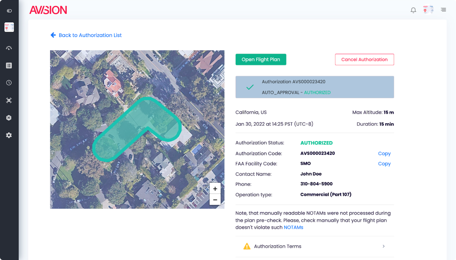

User reviews (0)