
 简体中文
简体中文 English
Website review
This review may include AI-generated content and is not individually verified. Domain, certificate and other facts come from the observed data on this page.
What is Metroscapes?
Metroscapes is a personal documentation project about the places where nature and the built environment meet, focused on the Greater Golden Horseshoe region of Ontario. Its core is an archive of over 3,000 kilometres of walks across six regions, supported by deeper project write-ups on watersheds, shorelines and riverbanks, neighbourhoods, hydro corridors and railways, plus a blog on public-realm issues. It reads as one person's long-term field record rather than a news outlet or an official planning resource.
Who it suits
- Residents who want to understand the creeks, rail lines and utility corridors running through their own area.
- Walkers, cyclists and photographers looking for routes beyond standard trail guides.
- Students, local historians and citizen groups researching land ownership, access and shoreline conditions.
How to use it
If you have a specific local question, start with the Projects section rather than the blog. A riverbank or watershed breakdown will usually answer "who owns this and can I reach it" more directly than a general post. Use the Walks archive when you want a route; use the Blog when you want context on why a place looks the way it does.
For a comparison point on Ontario trails and conservation areas, Ontario Trails and Toronto and Region Conservation Authority cover official routes and regulated lands, which is a different job from Metroscapes' independent observation and ownership analysis.
Trade-offs
The strength is depth and local specificity: pipeline corridors and riverbank ownership are the kind of detail mainstream guides skip. The limitation is that coverage is uneven and personal — it reflects where the author has walked, and its emphasis on the Greater Golden Horseshoe means it is of little use outside that area. The site also signals subscription options, so expect some content or updates to sit behind that rather than being fully open.
A useful next step: pick the region closest to you, open its project page, then cross-check any access or ownership detail against the relevant conservation authority before planning a visit.
How can I use Metroscapes to explore walks in the Greater Golden Horseshoe?
Start with the Walks section. Metroscapes describes its walk content as the site's foundation: over 3,000 kilometres of walks across six unique regions in the Greater Golden Horseshoe. Each walk is a route-based record, so the useful move is to pick a region first, then choose a walk that matches your available time and how much roadside or trail walking you are comfortable with.
A practical way to use it
- Open Metroscapes and go to Walks.
- Filter mentally by region: the site organises walks into six regions, so decide whether you want to stay near home or explore a specific watershed or corridor.
- Read the walk entry before setting out. These are documented routes, often tracing linear features such as pipelines, hydro corridors or railways, so the path may cross roads, industrial land or private property edges rather than follow a maintained trail.
- Combine a walk with a related Project page. Projects cover watersheds, shorelines and riverbanks, neighbourhoods, hydro corridors and railways, which gives context on ownership, access and why the route exists.
- Check the Blog for current issues and site developments that may affect a route.
Who gets the most out of it
- Local explorers who have already walked the standard conservation-area trails and want something more investigative.
- Urbanism and infrastructure readers interested in how pipelines, rail lines and hydro corridors shape the landscape.
- Photographers and map-minded walkers who prefer following a corridor end to end over a loop trail.
Trade-offs to expect
The appeal is depth and specificity, not convenience. Routes tied to infrastructure can be long, partly on-road, and less scenic than a park trail. There is also no single "best walk" list handed to you, so you need to browse by region and read entries. If you want a quick, waymarked afternoon hike, this is a research tool first and a trail guide second.
Next step: pick one region close to you, open its Walks list, and read two or three entries before choosing. If a walk follows a pipeline or hydro corridor, treat access as the deciding factor, not distance.
What types of local projects does Metroscapes cover, such as watersheds and shorelines?
Metroscapes groups its local coverage into three main areas: Walks, Projects, and a Blog. The Walks section is the site's foundation, documenting more than 3,000 kilometres of walking routes across six regions in the Greater Golden Horseshoe. The Projects section is where the local, place-based work sits, with deep dives into specific features of the landscape.
Project types covered
- Watersheds – explorations of local drainage areas and the natural systems they support.
- Shorelines and riverbanks – for example, a Niagara Riverbanks project breaking down ownership and access along the banks of five major Niagara waterways.
- Neighbourhoods – street-level looks at how residential and built areas are laid out and used.
- Hydro corridors – the utility land strips that cut through urban and suburban areas.
- Railways – rail lines and the corridors around them, treated as part of the everyday landscape.
- Pipeline corridors – a recent walk traces a pipeline corridor across upper Brampton, from Mt Pleasant to Castlemore Estates.
The common thread is the meeting point between natural and built environments, which is the site's stated focus. Rather than broad regional summaries, the projects tend to zoom in on one corridor, bank, or neighbourhood and examine who owns it, how it can be accessed, and how it functions.
Who this suits
If you are a local resident, urbanist, walker, or someone researching land ownership and public access in the Greater Golden Horseshoe, the Projects section is the most directly useful part. The Walks section works as a route library and evidence base, while the Blog covers current issues and site developments.
A practical next step: open the Projects section and start with a waterway or corridor near you, then cross-reference it with a matching walk in the same area. That pairing gives you both the analysis and the ground-level route. You can browse the site at Metroscapes.
How can I subscribe to Metroscapes and what do I get with a subscription?
Metroscapes does not appear to offer a conventional paid subscription with a defined bundle of benefits. The site's pricing signals point to "subscribe" or "subscription" language, but the visible page content frames the site around three free-to-browse areas: Walks, Projects and a Blog. In practice, "subscribing" likely means following updates rather than paying for access.
What the site actually offers
- Walks – the site's stated foundation: over 3,000 kilometres of walks across six regions in the Greater Golden Horseshoe, including recent additions such as a pipeline corridor walk in upper Brampton.
- Projects – deeper dives into watersheds, shorelines and riverbanks, neighbourhoods, hydro corridors and railways. A recent example is a breakdown of ownership and access along five major Niagara waterways.
- Blog – commentary on current issues affecting metroscapes, site developments and thoughts on improving the public realm.
- Video – a YouTube channel, including an annual year-in-review.
Practical next step
If you want to keep up with new walks, projects and posts, start with the site's own follow options rather than looking for a checkout page. Visit Metroscapes and use the menu or links to reach the Blog and recent activity, then look for a follow, newsletter or channel link there. You can also subscribe directly to the YouTube channel for video updates.
Decision criterion
Choose a paid subscription only if you find an explicit offer listing what you receive — for example, member-only maps, early access or downloadable routes. If no such offer is shown, treat Metroscapes as a free reference site and simply follow the sections most relevant to your area, such as the Niagara riverbank projects or walks near Brampton.
What recent content or updates are available on Metroscapes?
Metroscapes keeps three main streams of recent activity: a New Project on Niagara Riverbanks, a Latest Walk in Brampton, and a New Video looking back at 2025. The homepage surfaces each with a short summary and a link to the full section.
Recent items on the homepage
- New Project – Niagara Riverbanks: A breakdown of ownership and access along the banks of five major Niagara waterways. This is the most recent addition to the Projects section, which also covers watersheds, shorelines and riverbanks, neighbourhoods, hydro corridors, and railways.
- Latest Walk – Brampton Pipeline: A trace of a pipeline corridor across upper Brampton, from Mt Pleasant to Castlemore Estates. Walks are the site's foundation, with over 3,000 kilometres recorded across six regions of the Greater Golden Horseshoe.
- New Video – 2025 Year-in-Review: A recap of everything completed for Metroscapes in 2025, including a photo montage, hosted on the site's YouTube channel.
- Blog: Ongoing posts on current issues affecting metroscapes, website developments, and ideas for improving the public realm.
How to use this
If you want to see what's newest, start with the Niagara Riverbanks project for a focused ownership-and-access study, then compare it with the Brampton Pipeline walk to see how the site moves between analysis and on-the-ground routes. For a quick overview of the year's output, the 2025 video is the fastest entry point. If you prefer following along as things are published, the site invites visitors to subscribe.
As a next step, pick the region closest to you from the Walks section and check whether a recent walk covers it; the Projects and Blog sections are where new material tends to appear first.
How does Metroscapes compare to other resources for exploring natural and built environments?
Metroscapes is a niche, project-driven site rather than a general-purpose map or travel resource. Its own framing is "where natural and built environments collide," and the page presents three main entry points: Walks (described as over 3,000 kilometres of walks across six regions in the Greater Golden Horseshoe), Projects (watersheds, shorelines and riverbanks, neighbourhoods, hydro corridors, railways), and a Blog on current issues and site developments.
That combination is unusual. Most comparable resources specialise in one layer — official conservation-area trail listings, municipal or regional mapping portals, crowd-sourced hiking apps, or local history and urbanism blogs. Metroscapes sits between them: it treats infrastructure corridors, utility rights-of-way, rail lines, riverbanks and watershed boundaries as things worth walking and documenting, not just as background to a hike.
Where it fits best
- If you want to understand why a landscape looks the way it does — ownership patterns along a river, how a pipeline corridor cuts through a suburb — the Projects section is the distinctive part. A municipal map shows you the parcel; this kind of write-up tries to explain access and context.
- If you want route ideas, the Walks section is the core, but it is explicitly regional. Someone outside the Greater Golden Horseshoe will find little to use directly.
- If you want real-time trail conditions, elevation profiles, parking or navigation, a dedicated trail app or the managing authority's own site will usually serve you better.
- If you want broader coverage, general references such as Ontario Parks or Conservation Ontario cover protected areas and conservation authorities across the province, while OpenStreetMap is useful for tracing corridors and paths yourself.
A practical way to decide
Pick a specific place you already know — say a rail line or creek near you — and look for it in Metroscapes' Walks or Projects. If there is a detailed entry, the site offers something a generic map does not: an on-the-ground account of access, boundaries and the built-natural overlap. If there is no entry, treat it as a regional deep-dive rather than a comprehensive reference, and start from the relevant conservation authority or municipal mapping instead.
One caveat worth testing yourself: the site notes a YouTube channel and subscription language, so some material may be video-first or gated. Check whether the written walks and projects are readable without signing up before you commit time to it.
 GoDaddy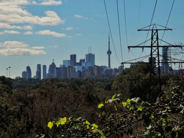

User reviews (0)